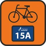
Stary Kolejowy Szlak
Plan, record and navigate on the go
All routes and points of interest in your pocket — with the free VeloPlanner app.


The Stary Kolejowy Szlak ("Old Railway Trail", cycle route no. 15) runs from the Baltic coast, starting in Kołobrzeg or Mielno, through Białogard, Połczyn-Zdrój and Złocieniec to Wałcz in the Wałcz Lake District (Pojezierze Wałeckie), and continues on local roads towards Piła. It is one of the main cycle routes in West Pomerania, crossing the Zachodniopomorskie region from north to south. More than half of the section between Kołobrzeg and Wałcz follows the embankments of former railway lines, which gives the route its name.
On the map the route looks like a stretched letter Y: the Kołobrzeg variant through Gościno and Karlino and the Mielno variant through Koszalin join in Białogard. Along the way you pass the moraine hills of Szwajcaria Połczyńska, the forests of Drawsko Landscape Park (Drawski Park Krajobrazowy), palaces, old railway stations and the fortifications of the Pomeranian Wall. Thanks to the gentle gradients of the old railway lines, even the highest parts of the Łobez Upland (Wysoczyzna Łobeska) take little effort.

Key facts about the Stary Kolejowy Szlak
- Route: Kołobrzeg or Mielno – Białogard – Połczyn-Zdrój – Złocieniec – Wałcz – Dobino – Skrzatusz – Piła
- Stages: the route operator defines four stages plus a starting variant from Mielno (stage IA)
- Difficulty: easy; the former railway sections have gentle gradients
- Profile: mostly gentle, with the hilliest terrain between Białogard and Połczyn-Zdrój
- Surface: mainly asphalt, with some paving stones; gravel and dirt roads mostly between Złocieniec and Wierzchowo
- Road type: mostly cycle paths and shared pedestrian and cycle paths; the longer sections in mixed traffic are Białogard – Połczyn-Zdrój and Wałcz – Piła
- Direction: the official description runs north to south, from the Baltic; there are railway stations in Kołobrzeg as well as in Wałcz and Dobino Wałeckie
- Bike: touring or gravel bike; a road bike also works if you take the detour via Osiek between Złocieniec and Wierzchowo
- For families: the verdict depends on the section; the rail trails Połczyn-Zdrój – Złocieniec and Wierzchowo – Wałcz are free of car traffic, while between Białogard and Połczyn-Zdrój and between Wałcz and Piła you share the road with cars (details below)
Is the Stary Kolejowy Szlak waymarked
The route is waymarked between Wałcz and regional road 102 near Kołobrzeg, which covers almost all of its built length. According to the operator, the Kołobrzeg – Bezpraw section has not been built yet, and the Wałcz – Piła stage is neither built nor waymarked. That last stage follows roads with little car traffic. In Złocieniec the route crosses the Western Lakelands Trail (Szlak Pojezierzy Zachodnich, route no. 20), and the two share the same line for just over 3 km.
On the unmarked sections, a track on your navigation device helps. You can download the GPX file for the whole route for free from the route page in VeloPlanner.

Stages of the Stary Kolejowy Szlak
The route operator divides it into four stages, with an additional starting variant from Mielno. The split is a guideline, and you can adjust it to your own pace.
Stage I: Kołobrzeg – Białogard. From Kołobrzeg the route follows mostly cycle paths to Zieleniewo, where the first section on a former railway line begins. From there you ride on asphalt through Gościno and Lubiechowo to Karlino, and from Karlino to Białogard on a cycle path alongside regional road 163. A longer alternative follows a gravel forest road and a quiet asphalt road past an unfinished German hydroelectric plant on the Parsęta river.
Stage IA: Mielno – Koszalin – Białogard. This variant from the coast runs through Koszalin and joins the main route in Białogard. Like Kołobrzeg, Mielno lies on the Velo Baltica (EuroVelo 10 and 13).
Stage II: Białogard – Złocieniec. The first part crosses rolling terrain on a county road with low traffic, past the palace in Rąbino and the medieval church in Lipie. After regional road 152, before Połczyn-Zdrój, you join a cycle path on the former railway line from Świdwin. Before reaching the town, the route turns onto an embankment that leads through Drawsko Landscape Park straight to Złocieniec. This is one of the first rail trails in Poland.
Stage III: Złocieniec – Wałcz. After Złocieniec the route shares just over 3 km with the Western Lakelands Trail, mostly on gravel; about 1 km before Bobrowo it becomes a dirt road that is hard to ride. After Bobrowo, forest asphalt turns into gravel all the way to Wierzchowo. From there, more than 30 km of rail-trail cycle path lead to Wałcz.
Stage IV: Wałcz – Dobino – Skrzatusz – Piła. This section is not yet built or waymarked. It follows quiet local roads through fields to Dobino, which sits between two lakes. Past the regional border, on the way to Piła, you pass the sanctuary in Skrzatusz.
What to see on the Stary Kolejowy Szlak
Along the route you will find the brick Gothic architecture of former Hanseatic towns, palaces, railway heritage and 20th-century fortifications. Some of these sights require a shorter or longer detour from the route.
Towns and monuments
- Kołobrzeg: the 220 m pier, considered the longest reinforced concrete structure in Poland; the Co-Cathedral Basilica of the Assumption; the Schliffen House on Gierczak Street, regarded as the oldest house in town; the Lont Tower (Baszta Lontowa) with a fragment of the 14th-century defensive wall. These three buildings are part of the European Route of Brick Gothic.
- Kołobrzeg, other sights: the 1945 monument to Poland's Wedding to the Sea, the neo-Gothic town hall, the water tower with a restaurant and microbrewery, the lighthouse and the spa park
- Zieleniewo: the "Wild West" amusement park (Park Rozrywki „Dziki Zachód”), a stop for younger cyclists
- Lubiechowo: a neoclassical palace rebuilt from ruins
- Karlino: the 1859 railway bridge over the Radew, opened in the presence of Wilhelm I; the bishop's island at the confluence of the Parsęta and Radew rivers, with the ground-floor remains of the castle of the Bishops of Kammin
- Białogard: the former town hall from 1827 with a wooden clock tower and a statue of Czesław Niemen in front; the ruins of an earlier town hall on the market square; the 14th-century High Gate (Połczyn Gate) with a metal stirrup linked to the legend of the "War over a Cow"
- Rąbino and Lipie: an early 20th-century palace and a church from 1462
- Połczyn-Zdrój: a spa town with a spa park and the Magic Umbrella Street (Magiczna Ulica Parasoli) above the promenade
- Złocieniec: Bison Park (Park Żubra) with Hornbeam Avenue, a tunnel formed by the crowns of 83 hornbeams around 200 years old; the foundations of the castle blown up in 1976; the "16 Południk" travel festival in April
- Kłębowiec: the ruins of the Goltz palace beside the route before Wałcz
- Wałcz: a medieval town centre layout between lakes Raduń and Zamkowe, the 1890 town hall, and the Avenue of Sports Stars by the lake
- Skrzatusz: a sanctuary with a 15th-century Pietà
Military sites and 20th-century history
- Cold War Museum in Podborsko: a former nuclear warhead depot, the only well-preserved one of three such facilities in Poland; open May to October. The detour from Białogard adds a dozen or so kilometres and passes the palaces in Żyletkowo and Dobrowo.
- Ordensburg Krössinsee on Lake Krosino near Złocieniec: a former Nazi training centre with two monumental towers. Today it is a military base, open to visitors during barracks open days or with the commander's permission.
- "Berlinka" beyond Cieszyno: remains of the unfinished Berlin – Königsberg motorway right next to the route
- Cegielnia fortified group (Grupa Warowna Cegielnia) in Wałcz, between lakes Zamkowe and Chmiel Duży: Pomeranian Wall bunkers blown up in 1945, a display of armoured vehicles and weapons, the "Kino na Bunkrach" open-air cinema, and re-enactments and concerts several times a year
- Pomeranian Wall Museum in the former barracks beyond Wałcz
- Open-air military museum in Zdbice (Skansen Bojowy) and a monument at the site where the Pomeranian Wall was broken through in 1945, on the variant via the village of Szwecja, about 17 km longer than the main route
Nature and landscape
- Drawsko Landscape Park: the Połczyn-Zdrój – Złocieniec railway embankment with former stations, many of which now have rest areas
- Szwajcaria Połczyńska: Wola Góra (219.2 m a.s.l.) with a fire lookout tower, the springs of the Drawa river, and the Valley of Five Lakes with the demanding "Połczyńska Garda" MTB trail
- Lake Zdbiczno and bunker remains on the variant via Szwecja
- "Magic Hill" (Magiczna górka) on the Strączno – Rutwica road, about 10 km west of Wałcz: a well-known gravity anomaly, in fact an optical illusion, where your bike seems to roll uphill
Is the Stary Kolejowy Szlak suitable for children
The route as a whole is not free of car traffic, so the verdict depends on the section. The Połczyn-Zdrój – Złocieniec and Wierzchowo – Wałcz sections run on cycle paths along former railway embankments and are suitable for children: there is no car traffic and the gradients are gentle. The operator marks the Złocieniec – Wałcz stage as suitable for families with children, but about 1 km of dirt road before Bobrowo is hard to ride.
Between Białogard and Połczyn-Zdrój the route follows a county road, where you share the carriageway with cars at low traffic volumes. Between Wałcz and Piła you ride on local roads with little car traffic. On the Kołobrzeg – Białogard stage cycle paths dominate, including the rail trail from Zieleniewo and the path along road 163, but the Kołobrzeg – Bezpraw section has not been built yet.
How to get to the Stary Kolejowy Szlak by train
Getting to the start
Kołobrzeg station is on the Kołobrzeg – Szczecinek line. If you are riding a cargo bike or tandem, towing a child trailer or carrying heavy panniers, get off at Kołobrzeg Stadion station. The route operator recommends it because it is easier to exit. You can check timetables at portalpasazera.pl.
Stations along the route
- Karlino: Kołobrzeg – Szczecinek line
- Białogard: Szczecin – Koszalin and Kołobrzeg – Szczecinek – Poznań lines; Intercity trains also stop here
- Rąbino: Szczecin – Koszalin line
- Złocieniec: Szczecin – Szczecinek line
- Świdwin: POLREGIO and Intercity trains; reached via the Złocieniec – Świdwin link, which also runs on a former railway line
Getting back
Wałcz, at the end of the built part of the route, has a station on the Szczecin – Wałcz line. If you ride further, Dobino Wałeckie station is on the Szczecin – Piła line. Trains in the region are operated by POLREGIO and Intercity.
Practical considerations
The route is technically easy, but a few spots are worth factoring into your plans. On a road bike you can ride almost the entire route, though between Złocieniec and Wierzchowo it is better to skip the gravel and dirt section through Bobrowo and go via Osiek instead. The Wałcz – Piła section has no waymarking, so use navigation there. In Kłomino near Borne Sulinowo there are bunkers similar to the one in Podborsko, but they are in poor condition and you should not enter them on your own.
Useful stops along the way:
- Rest areas at the former stations on the Połczyn-Zdrój – Złocieniec section
- Tourist information in Złocieniec with publications on the history of the town and region
- Railway stations in Kołobrzeg, Karlino, Białogard, Rąbino, Złocieniec, Wałcz and Dobino Wałeckie, which let you end your trip at almost any point
Final tips
The most rewarding detours cluster around Połczyn-Zdrój and Wałcz: Szwajcaria Połczyńska, the Cold War Museum in Podborsko, the Cegielnia fortified group and the variant via Szwecja all need extra time. If you are riding a road bike or with children, plan the Osiek detour in advance, or ride a shorter trip on the rail trails only.
Open the route in the VeloPlanner planner to split it into your own stages and add the detours you want.
Frequently Asked Questions
How do I get to the Stary Kolejowy Szlak by train?
Is the Stary Kolejowy Szlak waymarked?
Is the Stary Kolejowy Szlak suitable for children?
Can you ride the Stary Kolejowy Szlak on a road bike?
Where does the Stary Kolejowy Szlak start and end?
Plan, record and navigate on the go
All routes and points of interest in your pocket — with the free VeloPlanner app.


Comments
Log in to comment Ask a question or share a tip…No comments yet. Ask about closures, surfaces or places to stay, or share a tip from your ride.