Mittelland-Route (Switzerland)
Plan, record and navigate on the go
All routes and points of interest in your pocket — with the free VeloPlanner app.


The Mittelland Route (Route 5 of Veloland Schweiz) runs from Romanshorn on Lake Constance to Lausanne on Lake Geneva, crossing the Swiss Plateau via Wil, Winterthur, Aarau, Solothurn, the Three-Lakes region and Yverdon-les-Bains. SwitzerlandMobility, the national route operator, describes it as running mostly on traffic-free paths, and Switzerland Tourism calls it the most popular multi-day tour in the Swiss national cycling network.
This isn't a postcard route of Alpine passes. It follows the Thur, Töss, Limmat and Aare rivers and the shores of Lake Biel and Lake Neuchâtel, through orchards, vegetable fields, old towns, industrial zones and the approach to Zurich airport. The mix is the point: medieval bridges and baroque Solothurn sit alongside a nuclear power plant cooling tower, gravel quarries and the Hagneck hydroelectric plant. Along the way you cross the language border into French-speaking Switzerland and the European watershed between the Rhine and the Rhône.

Mittelland Route at a glance
- Duration: 7 days following the operator's official stages
- Difficulty: medium overall per SwitzerlandMobility; stage ratings range from easy (Romanshorn–Wil) to difficult (Kloten–Aarau and Solothurn–Ins)
- Elevation profile: gently rolling with long flat sections in the Three-Lakes region and the Orbe plain; short steep climbs to Winterberg near Winterthur and after Eclépens before Penthalaz
- Surface: mostly asphalt, with natural-surface sections such as the stretch between Brugg and Aarau and a rough forest section near Bussigny
- Route type: mostly traffic-free paths and farm tracks; between Yvonand and Yverdon-les-Bains the route follows the main road
- Direction: described and staged east to west, Romanshorn to Lausanne
- Recommended bike: touring or trekking bike; package operators rent touring bikes and e-bikes for the route
- Families: promoted for families by SwitzerlandMobility, though not traffic-free throughout: the Yvonand–Yverdon-les-Bains section runs along the main road, and the Winterberg and Penthalaz climbs are steep
How the Mittelland Route is signposted
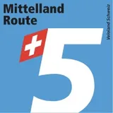
The route is part of the Swiss national cycle network and follows the red cycle signposts marked with route number 5. It is waymarked across all cantons it passes through, from Thurgau to Vaud, and the signage stays the same across the German–French language border.
Diversions do happen: as of September 2026, SwitzerlandMobility lists diversions or closures on the route, so check the operator's current notices before setting off. The GPX track is available directly in VeloPlanner, where you can load the whole route onto your device.
Which direction and when to ride
SwitzerlandMobility describes the route from Romanshorn to Lausanne, and its seven stages follow that direction. Riding west also means the landscape and language change gradually, from the Thurgau orchards through the German-speaking Aare towns into French-speaking Vaud.
Several highlights along the way are tied to specific months:
- Spring: fruit trees in bloom between Romanshorn and Bischofszell; wild garlic in the Töss forest south of Winterthur; storks nesting in Altreu
- Mid-April to mid-October: the Witi-Altreu information centre between Grenchen and Solothurn is open
- 21 March to 31 October: bike reservations are required on some Swiss InterCity trains (see Getting there)

Mittelland Route stages
SwitzerlandMobility divides the route into seven official stages, each ending in a town with a railway station. You can follow them or split the route your own way.
Stage 1: Romanshorn – Wil
The route leaves Lake Constance and heads into the fruit-growing country of Upper Thurgau, passing Hagenwil Castle, built in the early 13th century. A moorland nature reserve on a former peat extraction site has footpaths through it, and in Bischofszell the route meets the Thur, near a medieval stone bridge with eight arches. The final section runs along the Thur meadowlands, past the Thurauen Nature Centre, to the old town of Wil.
Stage 2: Wil – Kloten
Wil was the residence of the St. Gallen prince-abbots for centuries. The route passes Bichelsee, a small lake on the Thurgau–Zurich border with a beach, playground and boat rental, then follows the Töss valley on a paved road. Route 5 bypasses Winterthur on its south side through the Töss forest, then climbs steeply to Winterberg before reaching Bassersdorf and Zurich-Kloten airport.
Stage 3: Kloten – Aarau
Past the airport, the route reaches the reed-lined Chatzensee and Büsisee, a wetland with both low and high moorland. It follows the Furtbach through the Furttal to the Limmat, then to Baden's old town and the "water castle" region near Brugg, where the Aare, Reuss and Limmat meet. The last stretch from Brugg to Aarau runs mostly on unpaved roads through floodplain meadows.
Stage 4: Aarau – Solothurn
Aarau's car-free old town has rows of late Gothic houses. The route follows the Aare upstream past Bally Park in Schönenwerd, the Gösgen nuclear power plant and Olten's wooden bridge. After the Boningen gravel quarry nature reserve, with amphibian spawning grounds of national importance, it continues through Aarwangen and Wangen an der Aare, with its covered wooden bridge, to Solothurn.
Stage 5: Solothurn – Ins
From baroque Solothurn the route follows the Aare into the Three-Lakes region, past the Witi nature reserve near Grenchen and the stork village of Altreu. It crosses Büren an der Aare, passes the Häftli nature reserve on the Old Aare and continues through bilingual Biel/Bienne to Lake Biel. After the Hagneck hydroelectric plant, the route runs along the lake to Erlach and across the Grosses Moos vegetable-growing plain to Ins.
Stage 6: Ins – Yverdon-les-Bains
This stage crosses the Rotary Bridge between Lake Neuchâtel and Lake Murten, then follows the southern shore of Lake Neuchâtel past Cudrefin and the sand beaches of Yvonand. Between Yvonand and Yverdon the route follows the main road beside the Grande Cariçaie reed belt, with access points at the Cheseaux islands observation tower and the Centre de Champ-Pittet. Just before Yverdon, the route passes the Clendy menhirs.
Stage 7: Yverdon-les-Bains – Lausanne
From Yverdon the route crosses the flat, farmed Orbe plain past the Creux de Terre reserve near Chavornay, then climbs over Mormont, the watershed between the Rhine and the Rhône. It passes La Sarraz and Eclépens, climbs again before Penthalaz, and crosses the Venoge. A rough, hilly forest section near Bussigny leads into vineyards and the suburbs of Lausanne.

What to see along the Mittelland Route
The route links old towns, river landscapes and nature reserves of national importance. Most sights are directly on the route or a short detour from it.
Historic towns and buildings
- Hagenwil Castle: moated castle from the early 13th century, between Romanshorn and Bischofszell
- Bischofszell Thur bridge: late medieval, eight arches, Switzerland's longest preserved medieval natural-stone bridge (just off the route)
- Königsfelden monastery, Windisch: late medieval monastery known for its Gothic stained-glass windows
- Vindonissa, Windisch: remains of a Roman legion camp
- Aarau old town: late Gothic rows of houses, closed to motor traffic
- Olten: wooden bridge over the Aare and historic old town
- Wangen an der Aare: covered wooden bridge
- Solothurn: Switzerland's best-known baroque town
- Büren an der Aare: covered wooden bridge from 1821, rebuilt in 1991 after an arson attack
- Erlach: medieval town on Lake Biel
- Albert Anker's studio, Ins: the painter's studio, preserved almost in its original state, open for guided tours
- Yverdon-les-Bains castle: 13th-century Savoy castle housing a historical museum; Heinrich Pestalozzi ran his school here from 1804
- La Sarraz castle: core dating to the 11th century, with the 14th-century Saint-Antoine chapel nearby
Nature and landscape
- Thurauen Nature Centre: exhibits on riverside forests, near the Thur meadowlands with kingfishers, herons and beavers
- Chatzensee and Büsisee: small moorland lakes near Zurich, a stopover for great egrets during migration
- Witi-Altreu: nature reserve of national significance between Grenchen and Solothurn; storks resettled in Altreu in 1948, and Euronatur named it a European Stork Village in 2008
- Hagneck: where the Aare enters Lake Biel through the Hagneck channel, next to a hydroelectric plant opened in 2015
- Grande Cariçaie: a 40 km reed and marsh belt along Lake Neuchâtel's southern shore, with over 100 breeding bird species
- Clendy menhirs: prehistoric standing stones over 6,000 years old, on the route just before Yverdon
- Mormont: a 605 m hill on the main European watershed between the Rhine and the Rhône
Engineering and industrial heritage
- Jura water correction: the 19th-century project that lowered Lake Biel, Lake Neuchâtel and Lake Murten by 2.5 m and turned marshland into Switzerland's main vegetable-growing area
- Rotary Bridge: 250 m wooden arch between Lake Neuchâtel and Lake Murten, built for Expo.02 and closed to motor traffic
- Bally Park, Schönenwerd: an industrial-era park with miniature pile dwellings
- Zurich-Kloten airport: Switzerland's largest airport, with a public observation deck
Is the Mittelland Route suitable for families?
SwitzerlandMobility recommends the route for families because it runs mostly away from motor traffic, but it is not traffic-free throughout: between Yvonand and Yverdon-les-Bains the route follows the main road. Gradients are the other factor. The climb to Winterberg on stage 2 and the climb after Eclépens on stage 7 are steep, and the forest section near Bussigny is rough.
Several stops work well with children: Bichelsee has a playground, wading pool and boat rental, Altreu has its stork colony, and Cudrefin and Yvonand have lakeside lawns and sand beaches. Children aged 6 to 15 travelling with an adult take their own bike or trailer bike on Swiss trains free of charge, which makes shortening a day by train straightforward.
Where to stay on the Mittelland Route
Every official stage ends in a town with hotels and a railway station: Wil, Kloten, Aarau, Solothurn, Ins, Yverdon-les-Bains and Lausanne. Campsites along the route include one near Leutswil on the Sitter and several on the shore of Lake Biel near Erlach.
- Hotels and guesthouses: in all stage towns
- Camping: Leutswil (stage 1), Lake Biel shore near Erlach (stage 5)
- Luggage transfer: offered as part of self-guided packages by operators such as Eurotrek
Getting to and from the Mittelland Route
Getting there
Romanshorn has a railway station on Lake Constance with direct trains to Zurich. From Germany, a car ferry runs year-round, roughly hourly, from Friedrichshafen to Romanshorn, with a crossing of around 40 minutes; carry ID.
In Switzerland you need a ticket for your bike, either a single bike ticket or a Bike Day Pass (CHF 15 as of 2026). You load and unload the bike yourself. From 21 March to 31 October, a bike reservation is required on InterCity trains; on the IC5/IC51 lines, which run from Rorschach via Zurich and Biel/Bienne to Lausanne and parallel much of the route, it is required every day in that period.
Getting back
Lausanne station has direct connections back to Zurich and the Lake Constance region. The same IC reservation rules apply on the return. Since every stage town has a station, you can also cut the route short or skip a stage by train.
By boat
Two lake boat links can replace parts of the route: Solothurn–Biel/Bienne on the Aare, and Neuchâtel–Portalban across Lake Neuchâtel.
Practical considerations
The route passes through some of the most densely built parts of Switzerland. Stages 2 to 4 cross the Zurich agglomeration and the industrial Aare valley, with sections beside motorways, airports and factories alongside the quieter river paths. Stages 3 and 5 are rated difficult by the operator, so plan more time for them.
- Language changes from German to French around the Three-Lakes region; Biel/Bienne is officially bilingual
- Drinking water: fountains in villages such as Würenlos
- Rest spot with grill and shelter on the Sentier du Bois de la Côte near Bussigny
- Check SwitzerlandMobility for current diversions before each day
Final tips
Book IC bike reservations as soon as you know your travel dates, especially if you are returning from Lausanne on a weekend. Where a stage feels too long or a day turns wet, the dense Swiss rail network lets you skip ahead by train from almost any town.
The seven official stages are only one way to ride it. Open the route in the VeloPlanner planner to split it into days that fit your pace, or to add a detour to Bischofszell's medieval bridge or St. Peter's Island on Lake Biel.
Frequently Asked Questions
Do I need a bike reservation on Swiss trains?
Is the Mittelland Route signposted?
Is the Mittelland Route suitable for children?
How long does it take to cycle the Mittelland Route?
Where does the Mittelland Route start and end?
Plan, record and navigate on the go
All routes and points of interest in your pocket — with the free VeloPlanner app.


Comments
Log in to comment Ask a question or share a tip…No comments yet. Ask about closures, surfaces or places to stay, or share a tip from your ride.