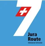
Jura-Route
Plan, record and navigate on the go
All routes and points of interest in your pocket — with the free VeloPlanner app.


The Jura-Route is Switzerland's national cycle route 7, running from Basel on the Rhine to Nyon on Lake Geneva through the Jura Mountains of western Switzerland, by way of Saignelégier and Vallorbe. Most of the route lies in the French-speaking part of the country, and it takes its name from the mountain range it crosses from end to end.
This is a route of repeated climbs rather than a river valley ride. The Jura-Route crosses a series of Jura passes and high plateaux: the fir forests along the Lucelle on the French border, the medieval town of St-Ursanne on the Doubs, the horse pastures of the Franches-Montagnes, the watchmaking city of La Chaux-de-Fonds, the moorlands of Les Ponts-de-Martel and La Vraconnaz, and Lac de Joux. It finishes with a long descent through vineyards to Lake Geneva.

Jura-Route at a glance
- Official status: national cycle route 7 in the SwitzerlandMobility network
- Start and finish: Basel (Schifflände boat dock) to Nyon on Lake Geneva
- Stages: SwitzerlandMobility divides the route into 6 stages
- Difficulty: rated difficult overall by SwitzerlandMobility; stages 3 and 4 are rated medium, the other four difficult
- Elevation profile: hilly throughout, with several passes and high plateaux; the Franches-Montagnes sit at 1,000–1,100 m and the Mont Soleil solar plant at 1,289 m
- Surface: mostly asphalt, with short natural-surface sections such as the forest track climbing out of Vallorbe
- Route type: a mix of city cycle tracks in Basel, farm tracks and roads shared with cars, tractors and, near Col du Marchairuz, motorbikes
- Direction: the official route description runs from Basel to Nyon, finishing with a descent to Lake Geneva
- Language region: starts in German-speaking Basel, then runs mostly through French-speaking Switzerland
How is the Jura-Route signposted
Like all national cycle routes in Switzerland, the Jura-Route is marked with red cycle route signs carrying the number 7. The same red signage continues on the connecting national routes at both ends, so the transitions in Basel and Nyon follow one consistent system.
The GPX track for the Jura-Route is available directly in VeloPlanner, where you can load the full route to your device before setting off.

Which routes connect to the Jura-Route
- Basel: Rhine Route (Rhein-Route) and North-South Route (Nord-Süd-Route)
- Nyon: Rhone Route (Rhone-Route)
Jura-Route stages from Basel to Nyon
SwitzerlandMobility, the operator of the Swiss national cycle network, divides the Jura-Route into six official stages. Each one ends in a town with services, and several stage ends are on the rail network.
Stage 1: Basel – Courtemautruy
The route leaves Basel at the Schifflände boat dock beside the Mittlere Brücke, the city's oldest Rhine crossing, and follows the line of tram 10 as far as Flüh. After the Benedictine monastery at Mariastein and the village of Metzerlen, a short climb leads to the Chall Pass (746 m), with views back over Basel, the Sundgau and Alsace. The second half follows the wooded Lucelle river along the Franco-Swiss border, past the village and small lake of Lucelle, then crosses open fields via Charmoille and Cornol to Courgenay railway station.
Stage 2: Courtemautruy – Saignelégier
From Courgenay a climb of about 300 m leads to the Col de la Croix, then the route drops past the farming village of Seleute to St-Ursanne on the Doubs. The route crosses the town's four-arched bridge at Porte Saint-Jean, and above the town there is a view of the railway viaduct. A second long climb reaches the Franches-Montagnes (Freiberge) plateau, crossed by drystone walls and wind turbines, before the villages of Les Enfers and Le Bémont lead to Saignelégier, the district's centre for horse breeding.
Stage 3: Saignelégier – La Chaux-de-Fonds
This stage continues across the Franches-Montagnes past the Etang de la Gruère, a moorland pond. A detour from La Chaux-des-Breuleux leads to Le Roselet, a retirement home for horses, donkeys and ponies. The climb to Mont Soleil (1,289 m) passes Switzerland's largest solar power plant and a wind farm, with views over the Vallon de St-Imier and the Chasseral towards the Alps, before the descent to La Chaux-de-Fonds.
Stage 4: La Chaux-de-Fonds – Fleurier
Leaving La Chaux-de-Fonds, the route passes farms and drystone walls into the Vallée de la Sagne et des Ponts. At Les Ponts-de-Martel, signed paths and footbridges cross the protected high moorland, where peat was cut for fuel until well into the 20th century. The route then drops into the Val-de-Travers along the Areuse, past the former asphalt mines, and on to Fleurier.
Stage 5: Fleurier – Vallorbe
From Buttes the route climbs over the Mont-de-Buttes to La Côte-aux-Fées and the La Vraconnaz moorland, then reaches the music box museums of L'Auberson and Ste-Croix. The hardest climb of the stage leads over the Col de l'Aiguillon below the Aiguilles de Baulmes ridge, followed by a descent to Baulmes with views of the Alps. The stage finishes via Ballaigues and the Le Day viaduct in Vallorbe, beside the dammed river Orbe.
Stage 6: Vallorbe – Nyon
The final stage opens with a bumpy uphill forest track out of Vallorbe, then follows the shore of Lac de Joux past Les Charbonnières. A second climb heads towards the Col du Marchairuz; the route leaves the main road before the summit and crosses the Parc Jura vaudois. The descent to Lake Geneva runs through wheat fields, vineyards and wine villages including Bassins before reaching Nyon. SwitzerlandMobility describes it as a long and demanding stage.

What to see on the Jura-Route
The Jura-Route links monasteries, watchmaking towns, protected moorland and cheese-making villages. The main sights directly on or near the route:
Towns and history
- Mariastein: Benedictine monastery, the best-known place of pilgrimage in north-western Switzerland
- St-Ursanne: medieval town on the Doubs with a 12th–14th-century Collegiate Church and crypt, three town gates and a four-arched bridge
- Courgenay: associated with Gilberte de Courgenay, the inn waitress who became famous among Swiss soldiers during the First World War
- La Chaux-de-Fonds: watchmaking city at about 1,000 m with a grid street plan and Art Nouveau buildings, a UNESCO World Heritage Site since 2009
- Bassins: six historic fountains, first recorded in 1688
- Nyon: castle, 16th-century townhouses and the Lake Geneva Museum on the shore
Museums
- International Watchmaking Museum, La Chaux-de-Fonds
- Asphalt mines of the Val-de-Travers, worked until 1986 and partly open as a museum
- Music box and automaton museums in L'Auberson and Ste-Croix
- Iron and Railway Museum, Vallorbe, on the bank of the Orbe
- Vacherin Mont-d'Or Museum, Les Charbonnières, birthplace of the cheese, which is only made between August and March
Nature and landscape
- Franches-Montagnes: high plateau at 1,000–1,100 m with pastures, firs, drystone walls and Franches-Montagnes horses
- Etang de la Gruère: moorland pond near Saignelégier
- Les Ponts-de-Martel: protected high moorland with walkways and a history of peat cutting
- La Mouille de La Vraconnaz: moorland above 1,100 m, the first Pro Natura conservation area, established in 1911
- Vallorbe caves: dripstone caves where the Orbe flows underground, a short detour off the route between Vallorbe and Lac Brenet
- Lac de Joux: lake in the Vallée de Joux below the Dent de Vaulion (1,483 m)
- Parc Jura vaudois: regional nature park covering 530.6 km², founded in 1973, known for its forests, sinkholes and large anthills
Engineering
- Railway viaduct at St-Ursanne on the Glovelier–Porrentruy line, built in the late 19th century with five tunnels and several bridges
- Mont Soleil solar power plant and wind farm
- Le Day viaduct near Vallorbe, 130 m high
Getting to the start and using the train on the Jura-Route
Start and finish
The Jura-Route begins at the Schifflände boat dock in central Basel, next to the Mittlere Brücke. It ends in Nyon on the shore of Lake Geneva, where it meets the Rhone Route.
Rail access along the route
Several points on the route have rail connections, which makes it possible to ride single stages. Stage 1 finishes at Courgenay railway station. Les Ponts-de-Martel is the terminus of the metre-gauge line from La Chaux-de-Fonds via La Sagne. Vallorbe lies on the TGV line.
Veloverlad: skipping climbs by public transport
SwitzerlandMobility suggests several points where you can load your bike onto public transport (a Veloverlad) to skip climbs. Using these transfers reduces the climbing on the Jura-Route considerably in both directions, which is worth knowing if you are riding without a motor.
Practical tips for riding the Jura-Route
The Jura-Route is a demanding ride, and conditions on the plateaux differ from the valley routes it connects to.
Carry enough drinking water. Many fountains in the Jura carry "Eau non potable" signs, meaning the water is not safe to drink.
Watch for farm and motor traffic. Tractors use the farm tracks and side roads between Courgenay and St-Ursanne and on the climb to the Mont-de-Buttes, and motorbikes are common on the road towards the Col du Marchairuz. On the Franches-Montagnes, wind turbines are a sign that it is often breezy on the plateau.
- E-bike riders should plan battery use around the climbs, such as the Col de la Croix on stage 2
- Stage 6 starts with a bumpy forest track above Vallorbe
- Nyon hosts the Paléo Festival at the end of July each year, worth knowing when planning a July finish
Final tips
The Jura-Route rewards riders who plan around the climbs: the operator's six stages are a starting point, but rail access at Courgenay, Les Ponts-de-Martel and Vallorbe and the suggested bike transfers give plenty of room to shorten days or skip the steepest sections. If you are coming from the Rhine Route, the route continues naturally from Basel; at the other end, the Rhone Route carries on along Lake Geneva from Nyon.
Open the Jura-Route in the VeloPlanner planner to split the stages to your own pace, for example with an extra night on the Franches-Montagnes or in La Chaux-de-Fonds.
Frequently Asked Questions
Which cycle routes connect to the Jura-Route?
Can I avoid the climbs on the Jura-Route?
Is the Jura-Route difficult?
How many stages does the Jura-Route have?
How is the Jura-Route signposted?
Where does the Jura-Route start and end?
Plan, record and navigate on the go
All routes and points of interest in your pocket — with the free VeloPlanner app.


Comments
Log in to comment Ask a question or share a tip…No comments yet. Ask about closures, surfaces or places to stay, or share a tip from your ride.