
LF Waterlinieroute
Plan, record and navigate on the go
All routes and points of interest in your pocket — with the free VeloPlanner app.


The LF Waterlinieroute (Waterline Route) runs from Edam to Bergen op Zoom along three historic Dutch water lines: the Amsterdam Defence Line, the New Dutch Water Line and the West Brabant section of the Southern Water Line. The first two together form the Dutch Water Lines, a UNESCO World Heritage Site since 2021.
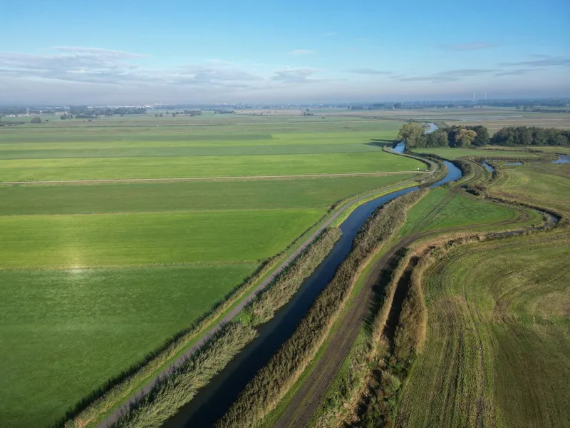
The water lines were built to stop an advancing enemy by deliberately flooding large areas of land. What remains is a chain of forts, batteries, line dikes and inundation canals that still shapes the landscape. Many forts now serve new purposes, from restaurants to art venues. The route often follows rivers, because rivers acted as natural barriers and supplied the water needed to flood the inundation fields.

What to know before riding the LF Waterlinieroute
- Start: Fort bij Edam, one of the best-preserved forts of the Amsterdam Defence Line
- Finish: Grote Markt in Bergen op Zoom
- Typical duration: 8 days, following the official stage suggestions
- Direction: the official stage descriptions run from Edam to Bergen op Zoom
- Heritage status: the Amsterdam Defence Line and New Dutch Water Line sections are part of the UNESCO Dutch Water Lines
- Ferries: several crossings, including Gorinchem to Woudrichem
- Optional boat section: the seasonal Vecht Bicycle Boat (Fietsboot Vecht) between Naarden and Utrecht
Navigating the LF Waterlinieroute
The GPX track for the full route is available directly in VeloPlanner, so you can load it onto your device before you set off. Along the Amsterdam Defence Line, brown information signs point out the less obvious traces of the line, such as earthworks and sightlines that are easy to miss from the saddle.
The street names also keep you on theme. Just past Spaarndam, the route uses roads called Genieweg, Stelling, Liniepad and Redoute, all named after parts of the defence works.

How the LF Waterlinieroute divides into stages
The official route website splits the LF Waterlinieroute into eight daily stages. They make a practical framework, though you can divide the ride differently to suit your pace.
Edam – Beverwijk
Find the entrance to Fort bij Edam before you start. The stage crosses the Beemster north of Fort Purmerend and passes Fort Resort Beemster, the former Fort aan de Nekkerweg. Leaving the North Holland Canal and the northern front behind, you follow the western front, which faced a possible attack from the North Sea, and finish at Fort aan de St. Aagtendijk in Beverwijk.
Beverwijk – Uithoorn
The day starts on the Vuurlinie. Near Haarlem, flooding the whole city was not an option, so three forts were placed close together to guard the railway, the towpath and the road: Fort bij Penningsveer, Fort aan de Liede and Fort bij de Liebrug. Further south, the Geniedijk embankment runs dead straight for more than 10 km through the Haarlemmermeerpolder and Hoofddorp, linking Fort Vijfhuizen, Fort Hoofddorp and Fort Aalsmeer before the stage ends past Fort aan de Drecht.
Uithoorn – Naarden
After Fort Uithoorn, the route follows the winding river Waver past Fort Waver-Amstel and Fort in de Botshol. Near Abcoude come the camouflaged front of Fort aan de Winkel, the Batteries at the Gein and Fort bij Nigtevecht. At Fort C (Muizenfort) near Muiden, you switch to the older New Dutch Water Line and ride on to the fortified town of Naarden.
Naarden – Utrecht
This stage follows the New Dutch Water Line, the largest national monument in the Netherlands. The route passes Fort Nieuwersluis, Fort Kijkuit and Fort Spion, with the Loosdrecht and Ankeveen lakes along the way. Before Utrecht, you pass Fort aan de Klop, Fort de Gagel and Fort Blauwkapel, part of the first ring of forts around the city.
Utrecht – Leerdam
The first ring around Utrecht (built 1816–1821) continues with Fort de Bilt, Fort Vossegat and the Lunetten, and the second ring (1867–1881) with Fort Ruigenhoek, Fort Voordorp, Fort Rijnauwen and Fort Vechten. Via the Plofsluis, you reach the Island of Schalkwijk, enclosed by rivers. After Fort Honswijk, Werk aan het Spoel and Fort Everdingen, a detour leads past Geofort and Fort Asperen to Leerdam, known as the glass city.
Leerdam – Geertruidenberg
From Leerdam, the route heads to the fortress town of Gorinchem and takes the crossing to Woudrichem into North Brabant. The Oudendijk stands out for its many group shelters: bunkers built just before the Second World War, each sheltering ten soldiers during bombardments. After Werk aan de Bakkerskil, the stage ends in Geertruidenberg.
Geertruidenberg – Dinteloord
Geertruidenberg holds the oldest city rights in the County of Holland. It received an earthen rampart and moat in 1213 and a wall with gates and rondels in 1319. From here, you follow the Southern Water Line, created in the early 18th century by linking existing defence lines and fortified towns, as far as Dinteloord.
Dinteloord – Bergen op Zoom
The route runs southwest alongside the Volkerak to the Benedensas, a lock complex from 1824 on the Steenbergsche Vliet. Its stairs give a view over the West Brabant Water Line, built around 1628 on the Brabantse Wal, a ridge of higher sandy ground east of Steenbergen and Bergen op Zoom. The final earthen rampart, the Ligneweg, leads into Bergen op Zoom, where the route ends at the Grote Markt.
Forts and sights along the LF Waterlinieroute
The route is essentially a ride through three centuries of Dutch military engineering. These are the main sights, grouped by water line.
Amsterdam Defence Line
- Fort bij Edam: one of the best-preserved forts on the line and the start of the route
- Fort Resort Beemster (former Fort aan de Nekkerweg)
- Fort aan de St. Aagtendijk in Beverwijk
- Fort bij Penningsveer, Fort aan de Liede and Fort bij de Liebrug, guarding the approaches to Haarlem
- Fort Vijfhuizen (Kunstfort), Fort Hoofddorp and Fort Aalsmeer along the Geniedijk
- Fort aan de Drecht and Fort Uithoorn
- Fort Waver-Amstel and Fort in de Botshol
- Fort aan de Winkel and the Batteries at the Gein near Abcoude
- Fort bij Nigtevecht
New Dutch Water Line
- Fort C (Muizenfort) near Muiden and the fortified town of Naarden
- Fort Nieuwersluis, Fort Kijkuit and Fort Spion
- Utrecht's two rings of forts, including Fort de Bilt, Fort Rijnauwen and Fort Vechten
- Werk aan de Groeneweg: bunkers and trenches visible from the Lekdijk, about 2 km past Fort Honswijk
- Fort Everdingen, Geofort (former Fort bij de Nieuwe Steeg) and Fort Asperen
- The fortress town of Gorinchem
- The group shelters along the Oudendijk
Southern Water Line and West Brabant Water Line
- Geertruidenberg: fortified city with walls dating back to the 13th and 14th centuries
- Benedensas lock complex (1824) on the Steenbergsche Vliet
- The West Brabant Water Line, activated six times between 1628 and 1830: once against the Spanish, four times against the French and once against the Belgians
- Bergen op Zoom, a fortified city the French called "La Pucelle"

Ferries, boats and practical tips
Ferries are part of the route, including the crossing from Gorinchem to Woudrichem. Sailing schedules change, so check the current times on veerponten.nl before each day's ride.
- The Vecht Bicycle Boat runs during the cycling season and can cover part of the Naarden–Utrecht stage.
- Some forts lie off the route: Fort bij de Liebrug is not visible from the route, and Fort Hoofddijk and Fort 't Hemeltje near Utrecht require a short detour.
- At Fort bij Edam, find the entrance before you start riding if you want to visit the fort.
Final tips
Build your days around the ferries and the forts you actually want to go inside. A visit can easily fill an hour, and the stretches with dense fort clusters, such as the approach to Haarlem or the rings around Utrecht, tempt you to stop often. If the eight official stages don't match your pace, open the route in the planner and split it your own way.
At the finish, the terraces on the Grote Markt in Bergen op Zoom are a fitting place to look back on a route where water itself was the weapon.
Frequently Asked Questions
Which water lines does the LF Waterlinieroute follow?
Are there ferries on the LF Waterlinieroute?
Is the LF Waterlinieroute part of a UNESCO World Heritage Site?
How many days does it take to cycle the LF Waterlinieroute?
Where does the LF Waterlinieroute start and end?
Plan, record and navigate on the go
All routes and points of interest in your pocket — with the free VeloPlanner app.



Comments
Log in to comment Ask a question or share a tip…No comments yet. Ask about closures, surfaces or places to stay, or share a tip from your ride.